
Gravimetry is the science that studies the gravitational field of the Earth and its variations, based on measuring the acceleration by which this field manifests itself. When talking about the Earth’s gravitational field, it does not only refer to the gravitational force exerted by the Earth, but also to all the forces that act on any body at rest on its surface. In other words, any body on or near the surface of the Earth is subject to the action of several forces, mainly the following three:
- Newtonian attraction of Earth’s mass (gravitation).
- Centrifugal force exerted by Earth’s rotation.
- Attraction generated by other celestial bodies in the solar system (tidal force) (See Fig.1)
The resultant of all these forces is called the force of gravity and is characterized by being a function of position and time.

[Ref.] https://moon.nasa.gov/moon-in-motion/tides/
Depending on the application of the observations there is interest in measuring the absolute value of gravity and in other cases the variation (temporal or location dependent) of gravity. A distinction is thus made between absolute and relative measurements of gravity, using different instruments in each case.
• Absolute gravity measurements: The total value of the acceleration of gravity at the point of observation (modulus of the vertical component of the acceleration of gravity) as a function of the fundamental observables, distance and time are determined by the absolute gravity measurements. Traditionally, two fundamental measurement methods have been distinguished:
- Pendulum method (no longer used today);
- Free fall method, based on the repeated fall of a mass in a vacuum and on the monitoring of its trajectories through the simultaneous collection of pairs of distance and time.
• Relative Gravity Measurements: All relative gravimeters are based on the balance of forces to measure variations in the gravity field between two different points or between two time points. This instrumentation is mainly divided into 3 groups:
- Pendular gravimeters;
- Spring Gravimeters: They are based on the stretching of a spring from which a mass hangs. When subjected to the action of the gravitational field and using a force to counteract changes in the field, the mass is kept in balance and therefore the gravimetry measured.
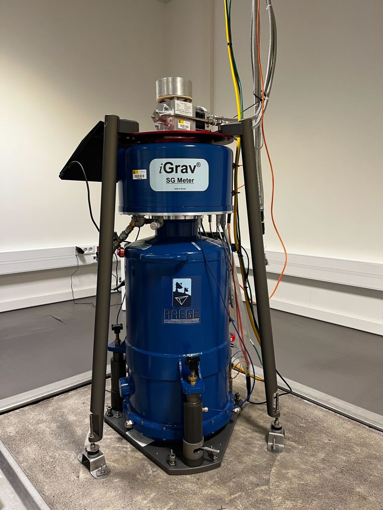
- Superconducting Gravimeters (SG): The suspension of mass using a spring is replaced by the magnetic levitation of a superconducting sphere. The introduction of SG in the 1980s drastically improved all studies of temporal gravity variations. Unlike spring gravimeters, the SG are characterized by unprecedented long-term stability, higher accuracy and significantly lower instrumental drift. By using magnetic levitation instead of a mechanical device, problems of mechanical and thermal effects are avoided. In Fig.2, the superconductive gravimeters network is depicted.

[Ref.] IGETS http://igets.u-strasbg.fr/
IGN Spain has several pieces of equipment from the last two groups.
Gravimetry is used both for the knowledge of the gravitational field and for other fields of study in which this knowledge intervenes in an auxiliary way, transforming the technique into multiple applications, among which the following stand out:
- Geoid determination (See Fig.5);
- Study of the Earth’s internal properties;
- Monitoring of volcanic processes;
- Prospecting for hydrocarbons and mineral resources;
- Archeology;
- High precision leveling;
- Studies on climate change;
- Determination of Earth orientation parameters;
- Metrology.
On the other hand, if we focus on the data recorded by superconducting gravimeters, the most common are:
- Historical records for the study and analysis of terrestrial tides;
- Applications in hydrology and volcanology, detecting variations and mass movements;
- Study of geodetic signals related to the different movements of the poles;
- Global geodynamic studies.

[Ref.] Image by GGOS.