

[Ref.] ggos.org

[Ref.] ggos.org
[Ref.] ggos.org
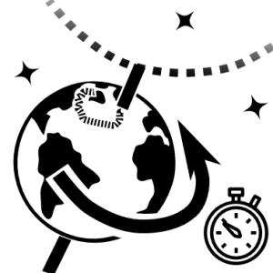
GGOS provides geodetic observations, data and products to the scientific and non-scientific community. Among these products are the reference frames required for all location-dependent observations, thus, contributing to the foundation of most Earth observations. Additionally, the measurement of the time-variable shape, gravity field, and rotation of the Earth are also some of the products distributed by the GGOS. With modern instrumentation and analytical techniques, Geodesy is now capable of detecting time variations ranging from large and secular scales to very small and transient deformations with increasing spatial and temporal resolution, high accuracy, and decreasing latency. There are several techniques that can provide the data required by the geodetic community, highlight the so-called Space-Geodetic techniques, among them VLBI (Very Long Baseline Interferometry), GNSS (Global Navigation Satellite System), SLR (Satellite Laser Ranging) and DORIS (Doppler Orbitography and Radiopositioning Integrated by Satellite), as represented in Fig.4.

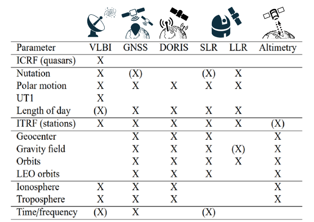
In Fig.5 the geodetic products of each space geodetic technique (VLBI, GNSS, DORIS, SLR, LLR, Altimetry) can be found. It is important to note that some of the techniques can provide common products and others are exclusive to a determined technique, e.g. the ICRF (International Celestial Reference Frame) is only possible to obtain using VLBI.
The co-location of the different space geodetic techniques is key in the realization of reference systems, as they allow the integration of the individual networks of each technique into a single system. Additionally, they provide an idea of the quality and precision of the systems themselves, thanks to the validation of the results between techniques. These multi-technique observatories allow the exploitation of the strengths of each technique and mitigate their weaknesses. This is realized by worldwide distributed Fundamental Space Geodetic Stations, which some of them are GGOS Core Sites. The GGOS Core Sites co-locate the major observation techniques and a variety of additional sensors and instruments (e.g. weather sensors, water vapour radiometers, etc.).
This is where RAEGE project finds its place. RAEGE (Atlantic Network of Geodynamic and Space Stations) is a project resulting from the cooperation between the National Geographic Institute of Spain (IGN) and the Government of Azores. It is an unique project at a geodetic and geodynamic level. It is devoted to the combination of geodetic techniques in four stations: two in Spain (Yebes and Gran Canaria) and two in Azores (Flores and Santa Maria). They will be Fundamental Space Geodetic Stations, being classified as GGOS core sites and/or GGOS co-location sites.
The RAEGE project focuses not only on the instrumentation and on operating the observations and stations, but also on developing analysis capabilities that allow RAEGE observatories to explode the geodetic observations. A VLBI analysis group, in the frame of RAEGE, has been established. The group consists of collaborators from the IGN, observatories of Yebes and Santa Maria and the University of Alicante. Among the objectives of this group are the promotion of the VLBI analysis activities in RAEGE project, expansion of its research activities, obtaining opportunities to participate in other international projects and/or interact with other groups, and testing and improving the capacity of new geodetic data.